- Understanding the National Weather Service's Forecasting Models
- Understanding the Role of Satellite Imagery in Severe Weather Forecasting
- Understanding the Role of Radar in Severe Weather Forecasting
- Understanding the Role of Ground-Based Observations in Severe Weather Forecasting
- Understanding the Role of Aviation Weather
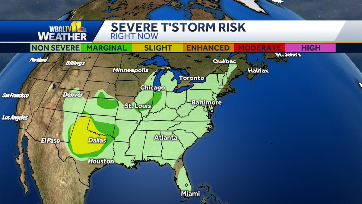
Severe Weather Outlook: Stay Informed with the Latest Forecast
As the weather continues to play a more unpredictable role in our daily lives, it's essential to stay informed about severe weather conditions. Severe weather events, such as tornadoes, hurricanes, and derechos, can cause widespread damage and disruption to communities. In this article, we'll provide an overview of severe weather outlooks, the importance of staying informed, and the ways to access the latest forecast.
Severe weather can be caused by a variety of factors, including warm, moist air near the surface and cooler, drier air above. When these two air masses meet, they can create a range of severe weather conditions, including thunderstorms, heavy rain, and even tornadoes. The National Weather Service (NWS) uses a variety of tools and models to predict severe weather events, including the Storm Prediction Center (SPC) and the Weather Prediction Center (WPC).
Staying informed about severe weather is crucial for several reasons. First and foremost, it can help save lives. According to the National Weather Service, severe weather events cause an average of 54 deaths per year in the United States alone. Additionally, severe weather can cause significant property damage, disrupt transportation and commerce, and impact the economy.
So, how can you stay informed about severe weather? There are several options available, including:
- National Weather Service Website: The NWS website provides up-to-date forecasts, warnings, and advisories for severe weather events across the United States.
- Mobile Apps: Many mobile apps, such as Dark Sky and Weather Underground, provide severe weather alerts and forecasts on-the-go.
- Television and Radio: Local news and weather reports on television and radio can provide timely updates on severe weather events.
- Social Media: The NWS and other emergency management officials often use social media to provide updates and warnings on severe weather events.
Understanding Severe Weather Watches and Warnings
When a severe weather event is forecasted, the National Weather Service issues a watch or warning to alert the public of the potential danger. There are three types of watches and warnings:
- Watch: A watch is issued when conditions are favorable for severe weather to develop. This means that there is a slight chance of severe weather occurring, but it's not a guarantee.
- Warning: A warning is issued when severe weather is imminent or already occurring. This means that there is a high chance of severe weather occurring, and immediate action is required.
- Advisory: An advisory is issued when conditions are less severe than a warning, but still pose a threat. This means that there is a moderate chance of severe weather occurring, and preparation is recommended.
Understanding Severe Weather Scales
The National Weather Service uses a variety of scales to describe the severity of severe weather events. These scales include:
- EF Scale: The EF scale is used to describe the severity of tornadoes. It ranges from EF0 (light damage) to EF5 (incredible damage).
- Radar Scale: The radar scale is used to describe the intensity of thunderstorms. It ranges from high-based thunderstorms to supercells.
- Wind Scale: The wind scale is used to describe the speed and direction of strong winds. It ranges from moderate winds to hurricane-force winds.
Understanding the National Weather Service's Forecasting Models
The National Weather Service uses a variety of forecasting models to predict severe weather events. These models include:
- Global Forecast System (GFS) Model: The GFS model is a global forecasting model that provides forecasts of severe weather events up to 16 days in advance.
- European Centre for Medium-Range Weather Forecasts (ECMWF) Model: The ECMWF model is a global forecasting model that provides forecasts of severe weather events up to 10 days in advance.
- North American Mesoscale Forecast System (NAM) Model: The NAM model is a regional forecasting model that provides forecasts of severe weather events up to 12 hours in advance.
Understanding the Role of Satellite Imagery in Severe Weather Forecasting
Satellite imagery plays a critical role in severe weather forecasting. Satellites in orbit around the Earth provide images of clouds, storms, and other severe weather events. These images are used to:
- Track storms: Satellites can track the movement and development of storms, providing early warnings of severe weather events.
- Provide detailed imagery: Satellites can provide detailed imagery of severe weather events, including the location, size, and intensity of storms.
- Detect severe weather signs: Satellites can detect signs of severe weather, such as thunderstorms, heavy rain, and hail.
Understanding the Role of Radar in Severe Weather Forecasting
Radar plays a critical role in severe weather forecasting. Radar systems use radio waves to detect precipitation and other severe weather events. These systems are used to:
- Detect storms: Radar systems can detect storms, including thunderstorms, heavy rain, and tornadoes.
- Track storms: Radar systems can track the movement and development of storms, providing early warnings of severe weather events.
- Provide detailed imagery: Radar systems can provide detailed imagery of severe weather events, including the location, size, and intensity of storms.
Understanding the Role of Ground-Based Observations in Severe Weather Forecasting
Ground-based observations play a critical role in severe weather forecasting. These observations include:
- Weather stations: Weather stations provide real-time data on temperature, humidity, wind, and other weather conditions.
- Radar stations: Radar stations provide real-time data on precipitation and other severe weather events.
- Lidar stations: Lidar stations provide real-time data on atmospheric conditions, including temperature, humidity, and wind.
Understanding the Role of Aviation Weather
Recent Post
Unlocking The Secrets Of Menopause: Expert Insights On Navigating Life After 40 With Paolo Tantoco
Tensions Rise As Trump Officials Defend Tariffs Amid Market Volatility And Warnings For Savers And Retirees
Rosie O'Donnell Teases Trump Move, Posts Disruptive Selfie From Abroad
Wings For The Win: Capitals Edge Ducks 7-4 In Thrilling Matchup
Ducks Fall Short: Key Takeaways From Thrilling 7-4 Loss To Capitals
Article Recommendations
- Elliot Timpf: Unfiltered Commentary And Unapologetic Truth-Telling
- Zhao Lusi: Age, Net Worth, Boyfriend, And Filmography
- Unveiling The Exquisite Beauty Of Candal: A Journey Of Elegance And Sophistication